Why Use Satellite Imagery For Your Business?
When you think of satellite imagery, you’re more likely to think of anything other than business. But with its ability to efficiently optimise and provide critical insight, many utilise satellite imagery and data to improve their business process. With the advancements in satellite technology, businesses now have access to high-resolution, near real-time data that can provide valuable insights and drive informed decision making. In fact many industries use satellite imagery to optimise their business strategies , including agriculture, urban planning, transportation, and defence, employing satellite imagery extensively to refine their operational strategies.
In this article, we’ll explore the benefits of using satellite imagery in business operations, the applications of satellite imagery in various industries, and how businesses can leverage the power of high-resolution and near real-time data to unlock success.
Where Can Satellite Imagery Be Applied?
The use of satellite imagery is vast and can be applied to many different industries. To illustrate the effectiveness of satellite imagery in businesses, let’s take a look at a few industries.
Agriculture
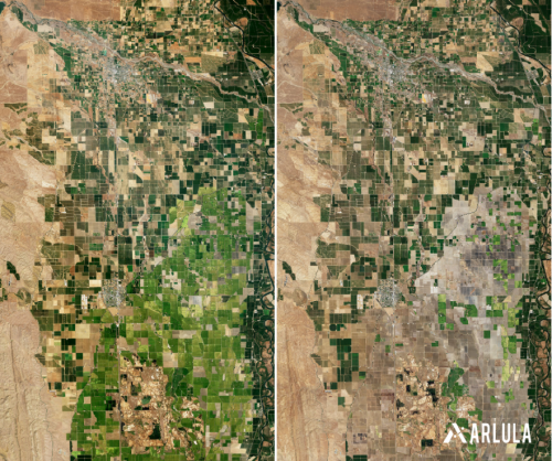
Agriculture plays a crucial role in our economy; however, it is a highly challenging business to master. Globally, farmers lose as much as $800 billion dollars worldwide caused by pests and pathogens. Satellite imagery is able to assist in these outcomes, revolutionising the way farmers are able to monitor crop health, optimise irrigation and predict yields. Multispectral imagery helped detect diseases and pests, allowing for immediate action and crop protection, resulting in higher profitability and sustainability.
This technology surpasses traditional methods in timeliness, cost-effectiveness, and coverage, enabling forecasts for large areas. In fact, satellite imagery was able to assist many farmers in the Midwest US in crop coverage. With many agriculture farms within the Midwest being large, crop coverage was often difficult to monitor and plan on the ground. However, thanks to a study conducted by NASA harvest using Sentinel and Landsat imagery, scientists were able to detect cover crops from above. Finding that almost all farmers which utilised crop covers for three or more years were able to see a reduction in yield.
Mining
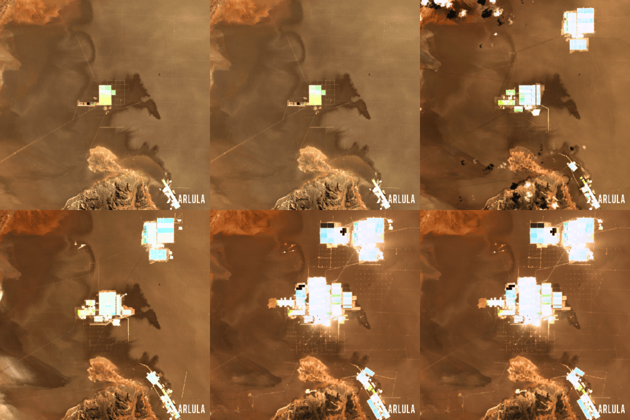
With around 80% of Australia’s mines still untapped for mineral resources, the challenges of traditional exploration methods are palpable. However, satellite imagery offers a game-changing solution by providing cost-effective and efficient means of exploration. By leveraging satellite data, mining companies can swiftly identify potential sites based on geological features and mineral signatures, streamlining the exploration process. Moreover, satellite imagery enables remote monitoring and management of mining operations, enhancing safety and efficiency. For instance, Anglo American, a global mining company, collaborated with the European Space Agency (ESA) in 2012 for mineral exploration in Brazil. By combining satellite data with ground-based geological information, the company was able to find new target areas of exploration thus leading to the discovery of new deposits.
Railway
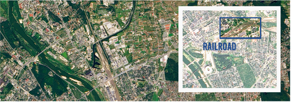
Anticipating and planning for potential incidents is crucial for railway organisations with an average of 1300 train derailments per year in the US alone. High-quality satellite imagery can be a solution to assist in identifying damaged rail lines and ground deformations, preventing derailments. It also aids in detecting intrusion points and encroaching vegetation along corridors, optimising maintenance response. Additionally, satellite imagery enhances route optimisation, fleet management, and supply chain monitoring in transportation and logistics, leading to improved efficiency.
Insurance
Satellite imagery is an invaluable asset for insurance companies, aiding in risk assessment, claims processing, and fraud detection. Through using high-resolution satellite data, insurers can accurately assess property risks, including natural disaster susceptibility and environmental factors, to determine appropriate coverage and premiums. Satellite imagery also plays a crucial role in claims processing, providing visual evidence of damage caused by events like floods, wildfires, or storms, facilitating quicker and more accurate claim settlements. Moreover, satellite imagery helps insurance companies detect potential fraud by verifying the accuracy of claim submissions against satellite imagery of the insured property, ensuring integrity within the claims process. Overall, satellite imagery enhances insurance operations’ efficiency, accuracy, and reliability, ultimately benefiting insurers and policyholders.
Construction and Urban Planning
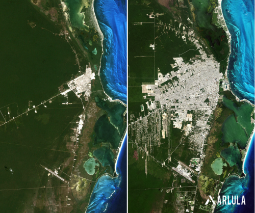
Satellite imagery facilitates efficient planning and monitoring of infrastructure upgrades and environmental projects, necessitating frequent and updated data. By adopting this data-driven strategy, cities globally can make informed decisions and preemptively safeguard communities during extreme weather events.
In construction, satellite imagery serves to monitor progress and preempt potential delays or complications, enabling timely corrective actions and cost savings. Additionally, it aids in asset maintenance and management, identifying issues before they escalate, thus reducing downtime, prolonging asset lifespan, and cutting expenses.
So How Does Satellite Imagery Benefit Your Business?
The use of satellite imagery offers numerous benefits for businesses across different sectors. One of the key advantages is the ability to gather data on a large scale and in near real-time. Satellite imagery provides businesses with a comprehensive view of their operations, allowing them to monitor and analyse their assets, supply chains, and infrastructure from a global perspective. This can help businesses identify potential risks, optimise their processes, and make informed decisions. Additionally, satellite imagery can also be used for disaster response and recovery, as it allows businesses to assess the impact of natural disasters and plan their response accordingly.
Another benefit of using satellite imagery is the ability to gain a competitive edge. By leveraging high-resolution satellite imagery, businesses can gather detailed information about their competitors, such as their infrastructure, facilities, and activities. This information can be used to identify market trends, predict customer behaviour, and develop targeted marketing strategies. Moreover, satellite imagery can also be used for site selection and land management, enabling businesses to make informed decisions about the location and development of their facilities.
Cost-saving Opportunities Through the Use of Satellite Imagery
In addition to providing valuable insights, satellite imagery can also help businesses save costs. These affordable options enable businesses to gather comprehensive information on vast land areas, enhancing efficiency and reducing exploration costs. Compared to traditional methods, such as sending teams to remote areas or using other monitoring techniques, satellite imagery is a more cost-effective solution. The Arlula platform has a variety of high-res satellite imagery from multiple leading investors, allowing you to access imagery with prices fit for your project.
Affordable satellite imagery options offered by the Arlula platform empower businesses to gather comprehensive information across vast land areas, significantly enhancing efficiency and slashing exploration costs. With satellite images available at various price points on the Arlula platform, businesses can access high-resolution imagery tailored to their project needs, avoiding the expenses associated with sending teams to remote areas or employing alternative monitoring techniques. This cost-effective solution enables extensive data collection on large land sets, surpassing the limitations and expenses of traditional methods.
By leveraging high-resolution satellite imagery, businesses can identify areas where cost savings can be made and take appropriate actions. For example, in the agriculture sector, satellite imagery can be used to optimise water and fertiliser usage, resulting in cost savings and reduced environmental impact. By analysing satellite imagery, farmers can identify areas of overwatering or overfertilisation and adjust their practices accordingly.

High-Resolution Satellite Imagery for Precise Business Applications
High-resolution satellite imagery provides businesses with the ability to capture detailed and accurate information about the Earth’s surface. This level of detail is crucial in various industries where precision is paramount. For example, in the mining industry, high-resolution satellite imagery can be used to identify potential mineral deposits, assess their viability, and plan extraction activities. By analysing high-resolution satellite imagery, mining companies can make informed decisions about resource allocation, optimise extraction processes, and maximise profitability.
In the environmental sector, high-resolution satellite imagery can be used to monitor deforestation, track wildlife populations, and assess the impact of climate change. By analysing high-resolution satellite imagery, environmental organisations can raise awareness, develop conservation strategies, and advocate for policy changes. Moreover, high-resolution satellite imagery can also be used for urban planning and development, enabling businesses to make informed decisions about infrastructure projects, land use, and zoning.
Leveraging Multispectral Satellite Imagery for Enhanced Business Outcomes
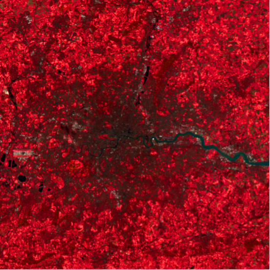
Multispectral satellite imagery refers to the capture of images using sensors that can detect multiple wavelengths of light. This allows businesses to gather information about different aspects of the Earth’s surface, such as vegetation health, water quality, and land cover. By leveraging multispectral satellite imagery, businesses can gain a deeper understanding of their operations and make more informed decisions. For example, in the agriculture sector, multispectral satellite imagery can be used to monitor crop health, detect diseases, and optimise irrigation practices. This can help farmers increase yield, reduce water usage, and minimise the use of pesticides.
In the forestry industry, multispectral satellite imagery can be used to monitor forest health, detect pest infestations, and assess the impact of logging activities. By analysing multispectral satellite imagery, forestry companies can develop sustainable logging practices, protect biodiversity, and ensure compliance with regulations. Moreover, multispectral satellite imagery can also be used for environmental impact assessments, enabling businesses to evaluate the potential impact of their activities on the environment and take appropriate measures to mitigate risks.
Near Real-time Satellite Imagery for Timely Decision Making
Real-time satellite imagery provides businesses with the ability to monitor their operations and make timely decisions. By accessing real-time satellite data, businesses can respond to changing conditions, identify emerging trends, and take immediate actions. For example, in the retail industry, real-time satellite imagery can be used to monitor customer footfall, identify peak shopping hours, and adjust staffing levels accordingly. This can help businesses optimise their operations, improve customer service, and increase sales.
In the transportation and logistics industry, real-time satellite imagery can be used to monitor traffic conditions, track vehicles, and optimise route planning. By analysing real-time satellite data, businesses can identify congested areas, reroute vehicles, and reduce delivery times. Moreover, real-time satellite imagery can also be used for emergency response and disaster management, enabling businesses to assess the impact of natural disasters, plan rescue operations, and allocate resources effectively.
Where to Get Started?
So how do you get started? Well with the Arlula Platform we’ve got you covered. With Arlula’s Geostack effortlessly navigate and conduct more refined searches for relevant data at speed and scale to help power your critical decisions and get the most out of satellite data.
Want to keep up-to-date?
Follow us on social media or sign up to our newsletter to keep up to date with new product releases and case studies.


