How Near Real-Time Satellite Imagery is Revolutionising Earth Monitoring
As technology continues to advance at an unprecedented pace, one area that has seen remarkable progress is the field of satellite imagery. With the advent of near real-time satellite imagery, scientists and researchers now have an incredibly powerful tool at their disposal for monitoring and studying the Earth. In this article, we’ll explore the significance of real-time satellite imagery and its impact on earth monitoring.
Why is Earth Monitoring Important?
Monitoring the Earth is of paramount importance in understanding the complex dynamics of our planet. From tracking climate change to detecting natural disasters, earth monitoring provides crucial data that can aid in making informed decisions. Near real-time satellite imagery takes this monitoring to a whole new level by providing up-to-date information with exceptional accuracy. By capturing high-resolution images of the Earth’s surface, these satellites enable us to observe changes and trends in real-time, allowing for timely intervention and response.
Benefits of High Resolution Satellite Images
One of the most significant advantages of high-resolution satellite images is their ability to capture intricate details of the Earth’s surface. Traditional satellite imagery often lacked the level of precision required for detailed analysis, but the emergence of high-resolution satellite images has revolutionised this aspect. These images provide an unprecedented level of clarity, allowing researchers to study phenomena such as urban development, deforestation, and land cover changes with remarkable accuracy. This newfound precision enables better decision-making in various fields, including urban planning, agriculture, and environmental conservation.
Additionally, high-resolution satellite images can be used to create accurate and up-to-date maps. By combining satellite imagery with advanced mapping technologies, scientists can generate detailed maps that aid in navigation, disaster response, and infrastructure planning. These maps provide valuable insights into the Earth’s terrain and can be instrumental in improving the quality of life for communities around the world.
Examples:
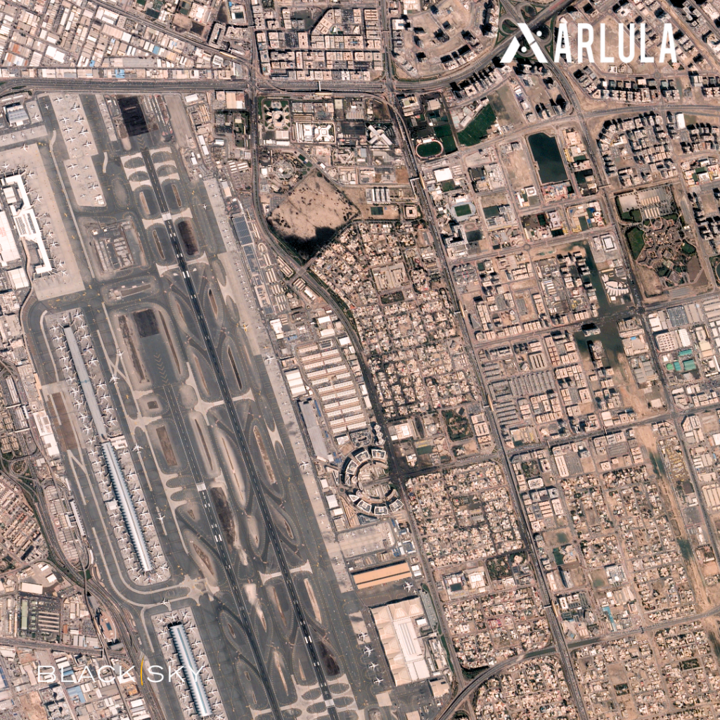
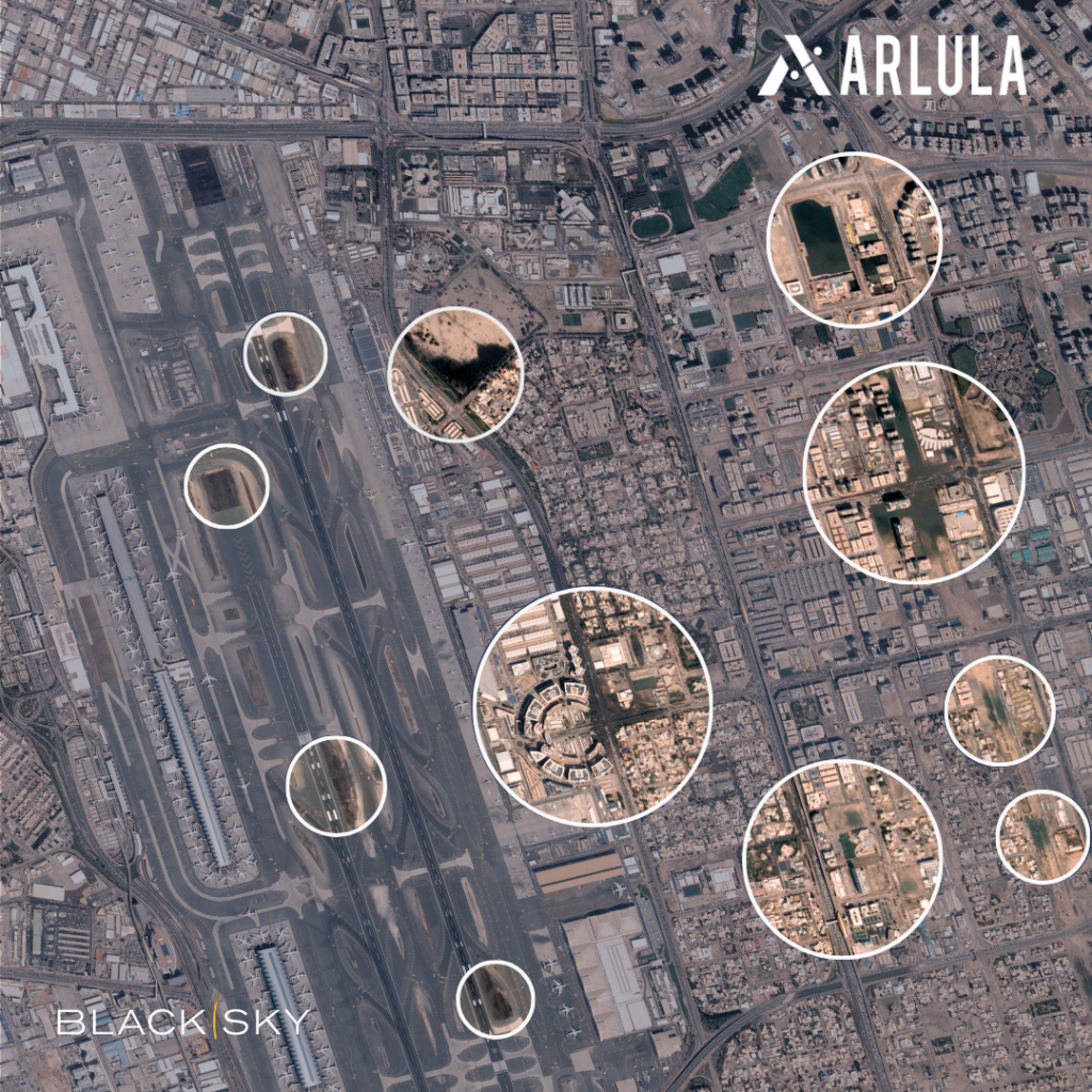
Dubai Floods 2024
In April, 2024 the UAE and Bahrain grappled with severe flooding as torrential rainfall inundated roads, homes, and malls. This historic storm brought more rain than the region has experienced in the last 75 years. With widespread flooding causing major flight delays and diversions at Dubai International Airport, the world’s busiest international air hub. By using near real-time satellite imagery tasked by Blacksky, we’re able to examine the residual flooding around the Dubai International Airport. Showcasing how rapid Blacksky tasking empowers local authorities and relief teams to strategically respond to natural events.
Cyclones in Queensland
Queensland faces a season of cyclones and severe storms from October to April, bringing destructive winds and floods. Near real-time satellite imagery provides a game-changer. These satellites capture multiple high-quality images daily, allowing meteorologists and officials to closely track approaching cyclones, even those threatening remote islands. This detailed monitoring leads to earlier and more accurate warnings for potentially impacted communities.
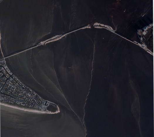
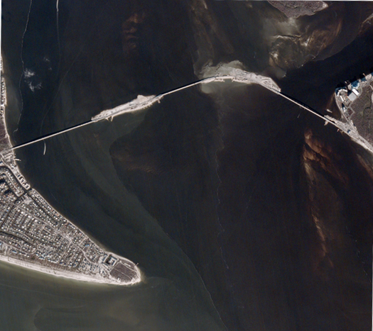
Beyond tracking, repeated imaging from BlackSky assists in assessing the damage after the storm passes, as in these images from before and after a hurricane in Florida 2022. This reveals critical information in near real-time, pinpointing damage to houses and vital infrastructure. This dynamic approach allows for rapid damage assessments and swift responses, accelerating emergency relief efforts.
How to Get Started Today with Near Real-Time Satellite Imagery
Accessing near real-time high-resolution imagery is now more accessible than ever before. With the Arlula platform, one is able to easily schedule new satellite image captures from all of the major vendors through an easy to use interface. In addition, tasking allows you to customise your experience in obtaining satellite imagery through a range of providers, specifying time frame, and area. Get started today with Arlula.
FAQ’s
Want to keep up-to-date?
Follow us on social media or sign up to our newsletter to keep up to date with new product releases and case studies.


