Geostack
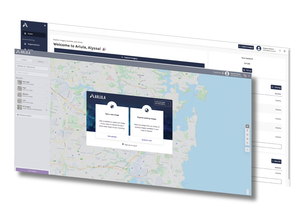
A software solution for Earth Observation missions
Geospatial Solutions
Automate
Streamline data distribution with automated satellite tasking and order management
Collaborate
Geostack is a central access point to all of your organization’s drone, aerial and satellite data in one platform.
Access
Make your organization’s spatial data discoverable with simple search and index capabilities
Manage
Leverage permissions and collections to securely manage and share geosptaial data sets and licensing terms
Scale
Flexible pricing plans optimize costs while scaling profitability.
Visualize
Advanced tools empower users to visualize and share datasets to develop data-driven insights and make informed decisions.
Why Geostack?
Before Geostack:
With Geostack:
Data Silos
Critical information is fragmented with data is stored separately without sharing or integrating
Centralized Platform
Set up teams and customers and share data libraries to collaborate more effectively.
Growth Challenges
Inefficient processes result in necessary costs and prevent scaled growth.
Scale Operations
Manage geospatial data at scale through a centralized platform and overcome challenges with complex order support.
Inefficient Data Procurement
Complex licence negotiations and back-and-forth communications complicate data access
Streamlined Data Access
Access premium suppliers, automate delivery, and simple whole of Organization and bespoke EULAS.
Security & Compliance Risk
Dispersed data is difficult to manage protocols, control access and ensure compliance.
Secure Data Management
Easily manage team and customer permissions through the platform.
Use Cases
Explore By Role
Learn more about Geostack
If you’d like to learn more about Arlula’s Geostack platform, please register your interest in the contact form and we’ll get in touch with you.


