Access a global network of satellite imagery
One platform to meet all of your imagery needs
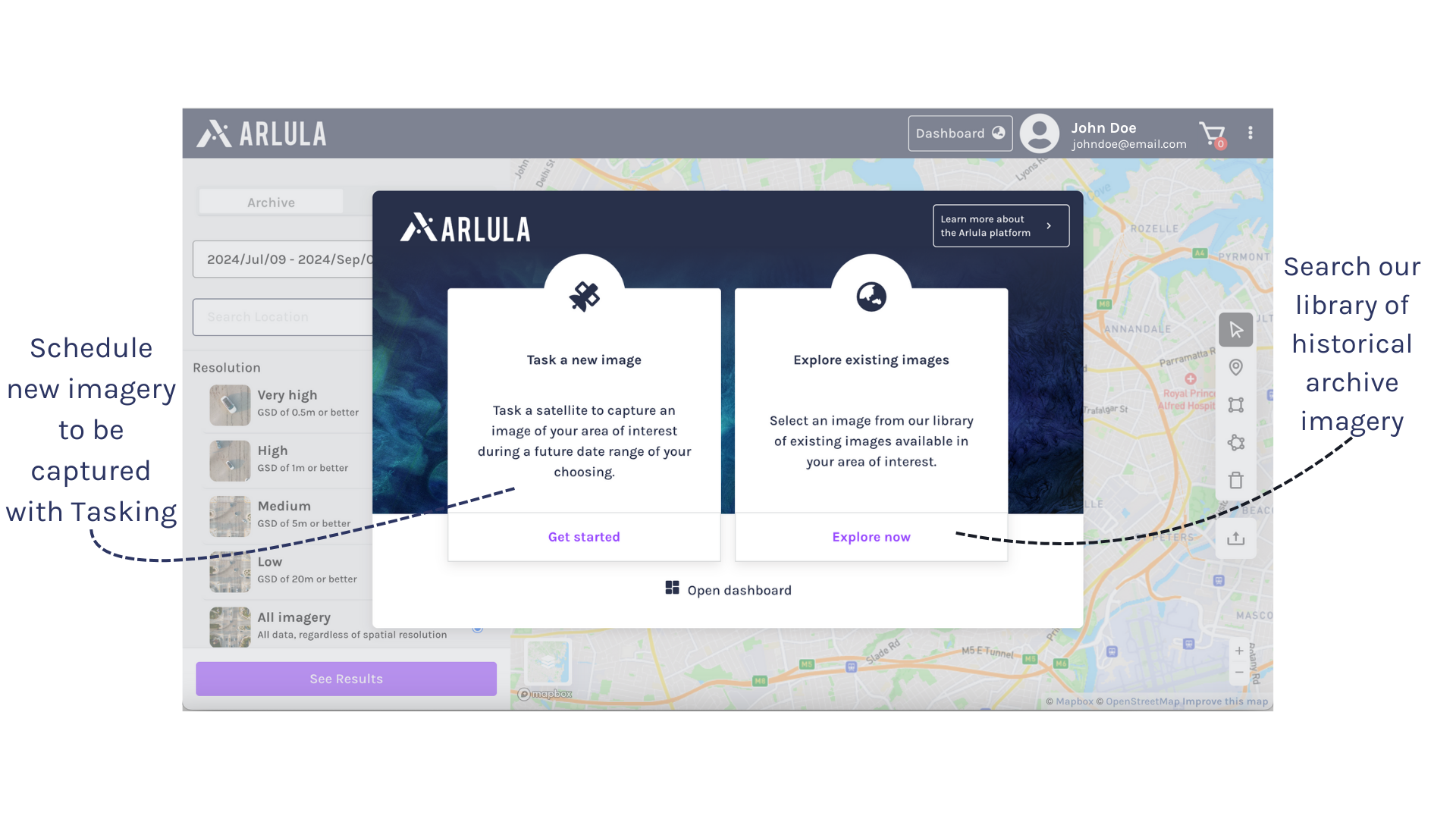
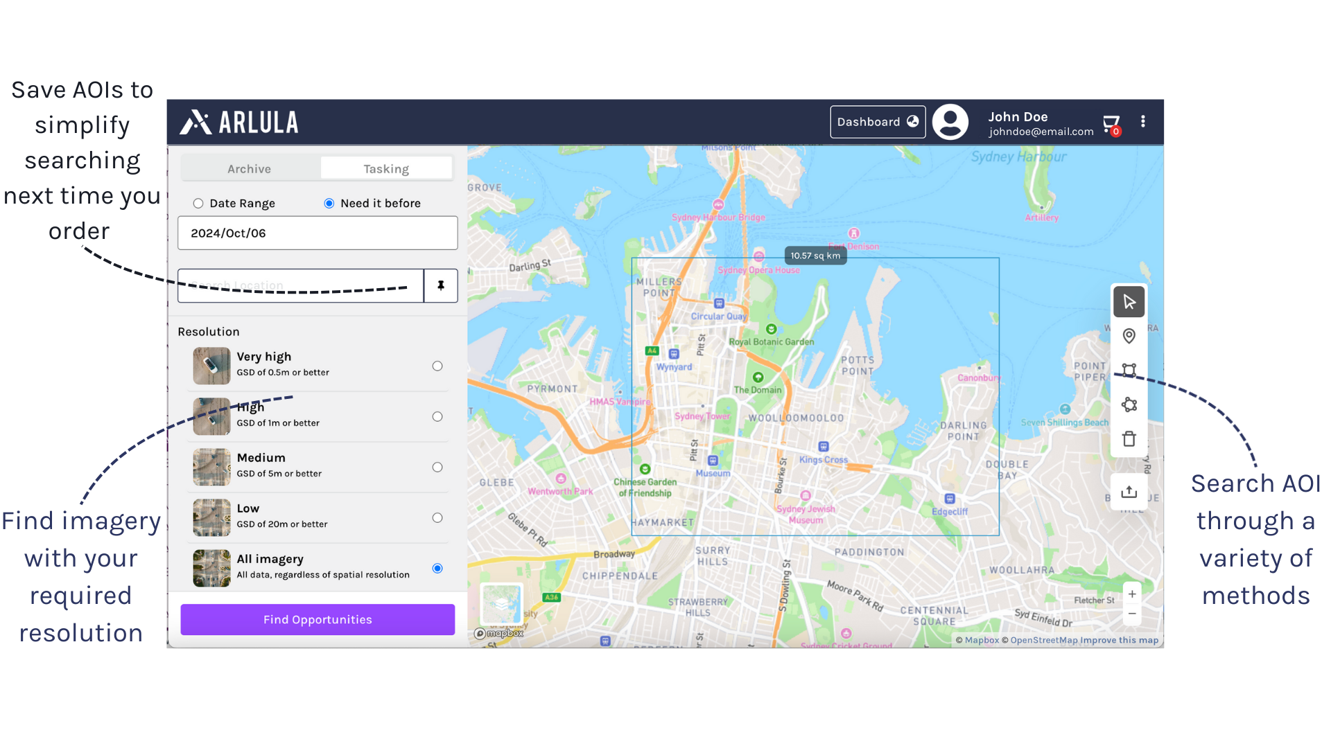
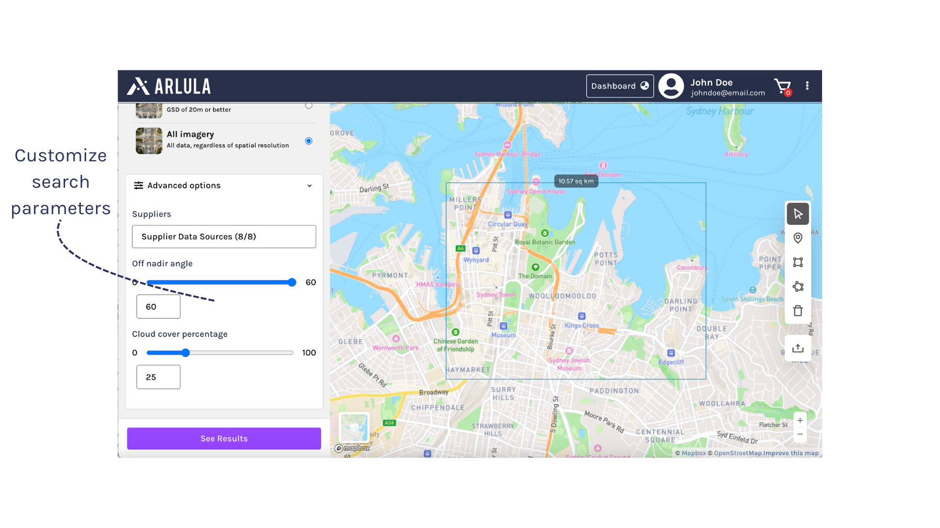
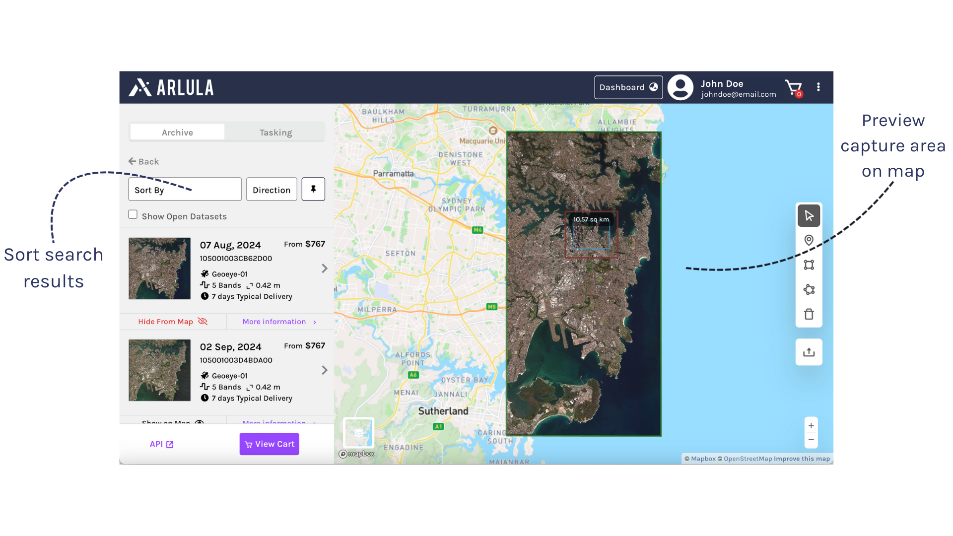
Search & Discover Spatial Data
The Geostack platform enhances situational awareness and improves decision-making capabilities for small and large organizations alike. Rapid geospatial data acquisition and distribution through a single platform, allows users to access and procure data up to 100 times faster than traditional imagery solutions. With standardized access to your existing satellite data as well as a network of satellite operators and a variety of data types, including Multispectral, SAR, and Hyperspectral, the platform provides businesses with unique domain insights that they can use to power critical decisions.
Buy Satellite Imagery
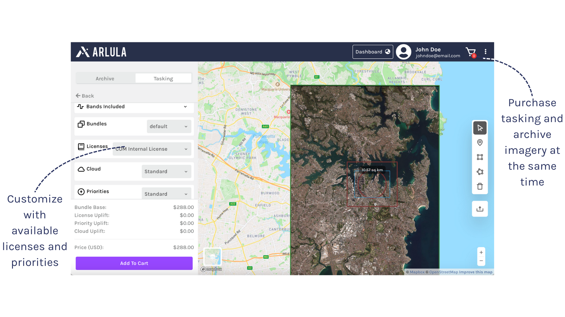
Satellite Tasking
Order near real-time satellite imagery to stay up to date and informed. Our network of providers ensures quick image capture, timely delivery and reliable results.
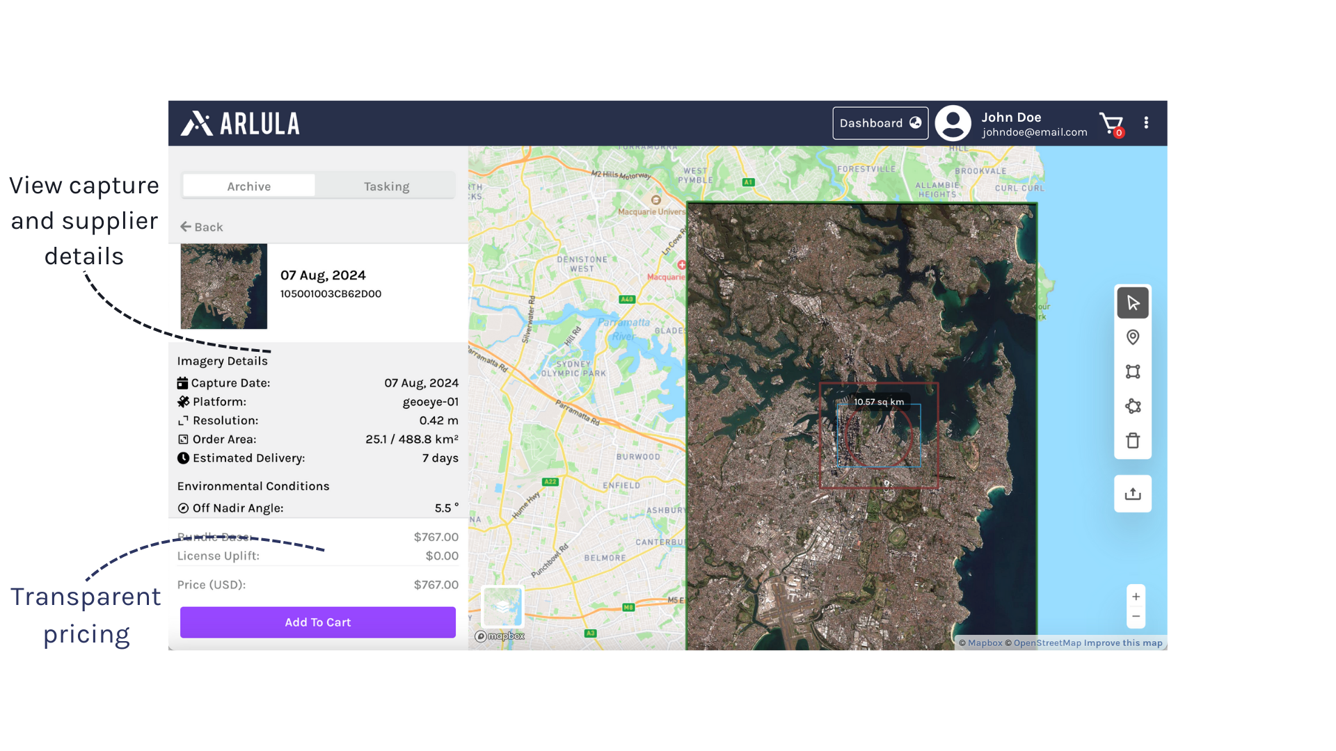
Archive Imagery
Access decades of satellite imagery from around the world. Arlula aggregates extensive satellite imagery archives from our global network of data suppliers to ensure you have a full picture of the Earth.

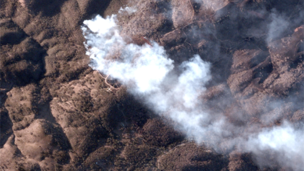
Monitoring Campaign
Monitor assets remotely, identify patterns and respond to changes quickly with cutting-edge high resolution satellite imagery and data management tools.